Maptech's Outdoor
Navigator -A PDA Program to Accesses US Topo Maps and Marine Charts
(Get to your appointment
on time -without getting lost!)
(21 Jan. 2005 -Add Operation) Text by Jack
Yeazel and Jeffrey Seigel
Return
to GPS General Information Home Page
(Click on thumbnails for larger
views)
 ..
.. ..
.. ..
..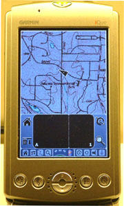
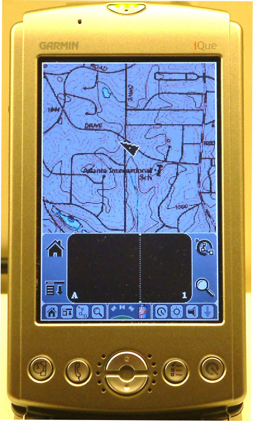
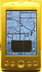
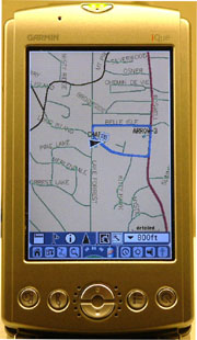
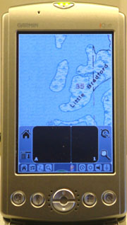
Comparison of CitySelect and Maptech
Topo Maps Displayed on Garmin's iQue 3600
OVERVIEW:
Outdoor Navigator is available (HERE)
for $19.95 ( or a trial version is free). This PDA program provides
easy access (at no additional charge) to the USGS database of over 58,000
USGS topographic maps covering the continental US. These include
all the available 1:24,000, 1:25,000, 1:63,360, 1:100,000, and 1:250,000
topo map scales. These maps will switch automatically as you travel
along.
Outdoor Navigator will function on a number of Palm or Pocket PC
devices. Handhelds like the Mio 168 and Garmin iQue have built-in
GPS. There are also GPS add-ons for most handhelds including Bluetooth
GPS antennas that transmit your position wirelessly to your handheld.
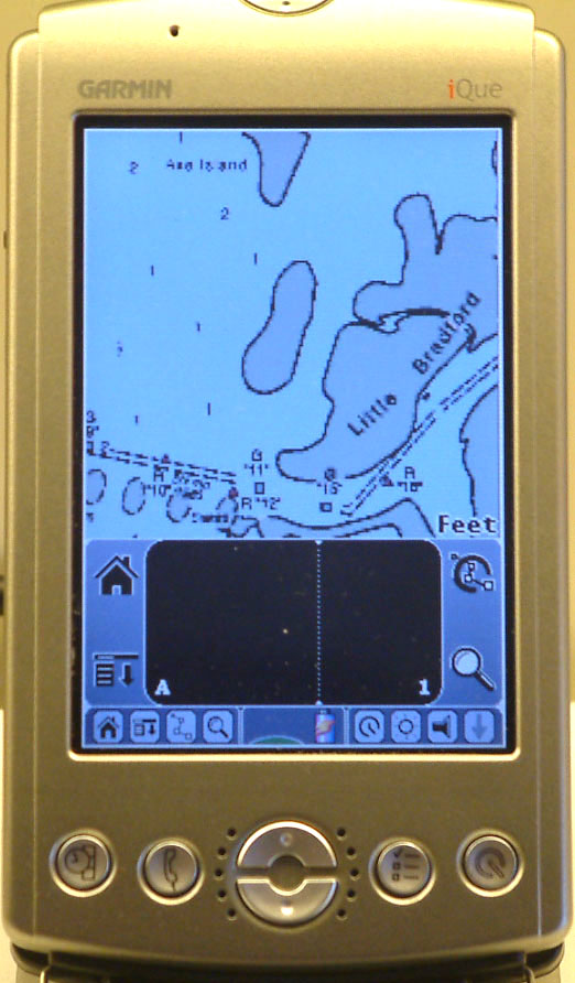
At the mouth of the Suwannee River
 .....
..... .....
.....
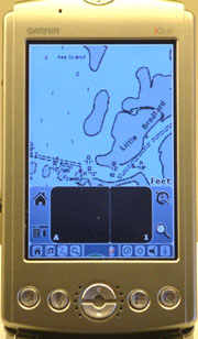
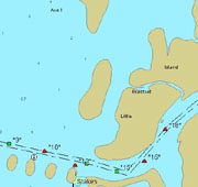
Maptech Marine Chart *
Garmin BlueChart (Not Free!) * Maptech Topo Map
Over 2,300 NOAA Nautical Charts are free to download. Better
charts equals safer boating. Outdoor Navigator includes easy download access
to NOAA nautical charts covering the US. These include all available chart
scales with the best detail.
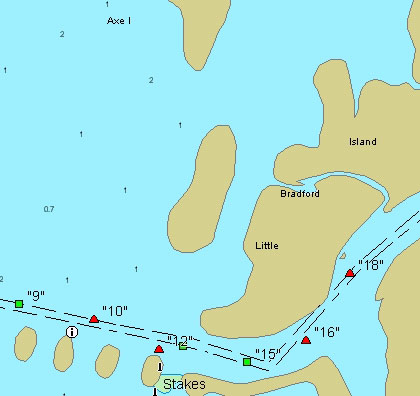
NOAA digital charts are the "legal" standard for marine navigation.
Ideal for sea kayaks, sailboats, and powerboats. Or use as a back-up navigation
system on larger vessels. Dry bags are available for wet environments.
INSTALLATION:
Steps for installation are clearly described (HERE).
Run the .exe file and read the help file to get the activation code.
The Outdoor Navigator Mapserver Website is (HERE).
This page provides a number of methods to select your maps -by Name, Location,
Zip Code, or Latitude/Longitude.
Once the program is installed, run the Outdoor Manager program and
read the Help File to see how to upload maps to the PDA. The maps
are downloaded as .ONM files which when clicked on, launch Outdoor Manager.
From Outdoor Manager, you select the maps you want uploaded to the PDA.
Unlike uploading Garmin maps, the existing maps are not erased, but are
added to.
OPERATION:
The lower icon to the left of the scratch pad is the main Outdoor
Navigator drop-down menu. This menu accesses: Options, View, GPS,
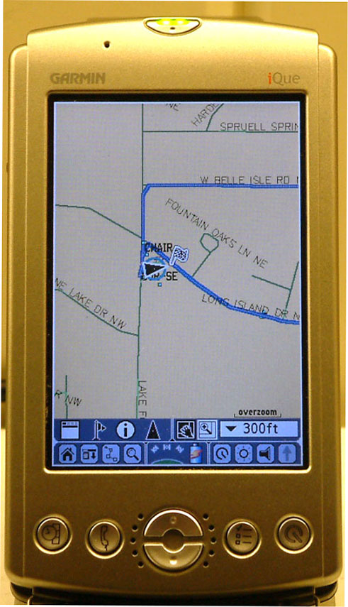
and Help. From Options: Maps and Marks (waypoints) are accessed.
From View: you access Data Boxes (see below) and the Follow Mode (causes
the map to pan as you go along). Dragging the stylus across the map
causes it to pan. (Then Follow Mode must be activated to resume automatic
pan).
Waypoints are created by pressing the stylus on the map. This
waypoint can be made either Active and/or Locked. If Active, then
a blue bearing line from present position to the Active waypoint is shown.
If not Locked, then the waypoint can be moved around the map with the stylus.
Pressing Data Boxes causes three boxes to appear at the bottom
of the map. Each box can have: AVE
SOG, COG, GPS POS, WPT RNG, WPT BRG, WPT TTG, PEN RNG, PEN BRG, PEN POS,
RTE XTE, RTE DTG, RTE TTG, or SOG. The PEN
boxes refer to where the stylus is placed on the map, and the WPT
boxes
refer to the Active waypoint.
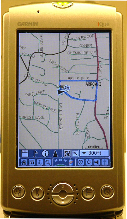
Routes are created by marking the first point and classifying it
as a New Route. Continue to Add Waypoint Here at the various route
points. At the last point, select Add Waypoint and Save Route.
From the Routes menu, select the route name and Edit it. Two options
are to Activate the route and/or Lock the waypoints. Activating the
route will also activate the RTE
data boxes. The route lines are in red (whether activated or not),
and a blue bearing pointer always points to the next waypoint.
COMPATIBILITY:
Palm - any device with these: Palm OS v4.0 or later, Color screen,
Memory card slot.
Pocket PC - any device with these: Windows Mobile for Pocket PC
2002 or later.
Smartphone - any device with these: Windows Mobile for Smartphone
2002 or later.
CONS:
The program doesn't allow hiding the scratch pad, but the company
promises that full screen support is being added and will be a free update.
Although one can create waypoints by pressing and holding the stylus on
the Outdoor maps, they can't be uploaded from a database. As of this
time, tracks are not provided. Tracks are being added this year also.
All updates to the software will be free so everyone will get all of these
things.
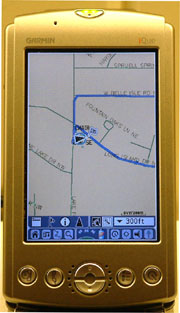
With the Garmin maps, tracks are provided, but are 'invisible' on
the daytime maps. The blue line on the CitySelect maps (above) is
a SAVED track -which is visible with several selectable colors.
CONCLUSION:
One of the best values we've seen for PDA and GPS users.
 ..
.. ..
.. ..
..