Journey to the North Pole with Sarah (2007)
And her (ancient) Garmin Legend! ° Text
by jack yeazel °
Photos
by Sarah Gilboe ©
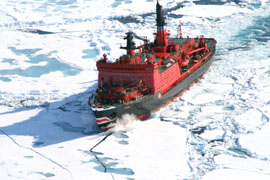
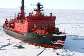
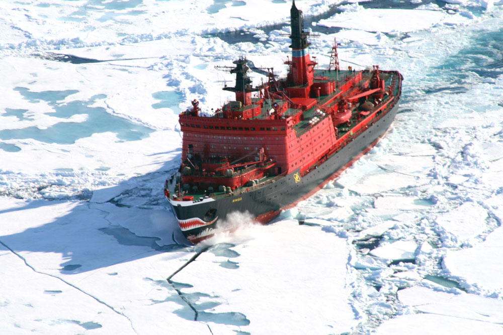
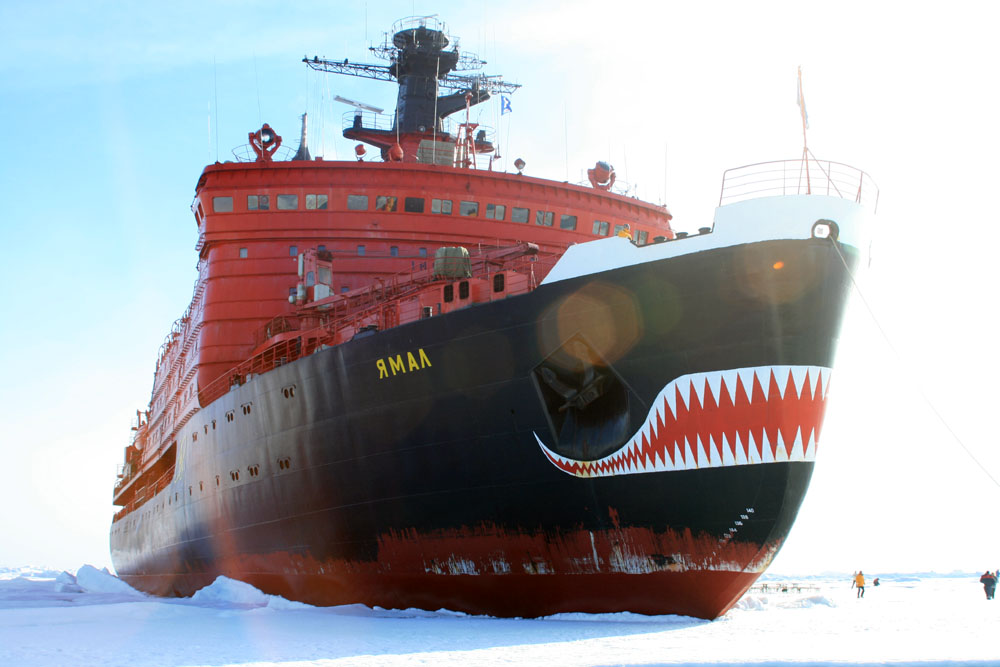
Her cruise started from Murmansk. Russia and traveled
to the North Pole on the nuclear-powered
Russian icebreaker, Yamal, used as a 100-passenger
cruise ship during the summer.
You might be interested in reading how to set your
GPS to UPS Polar Coordinates (HERE)
The cruise was provided by Quark
Expeditions.
(Click
on the pictures below for larger sizes)
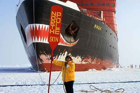
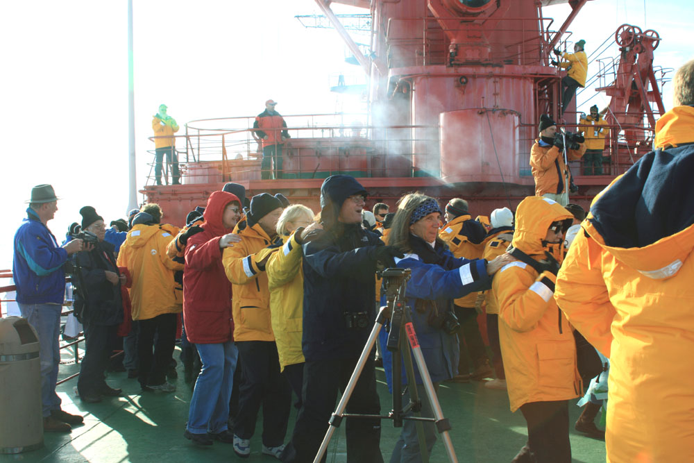
Sarah Guides the Russian Nuclear-powered Icebreaker
to the Proper Spot!
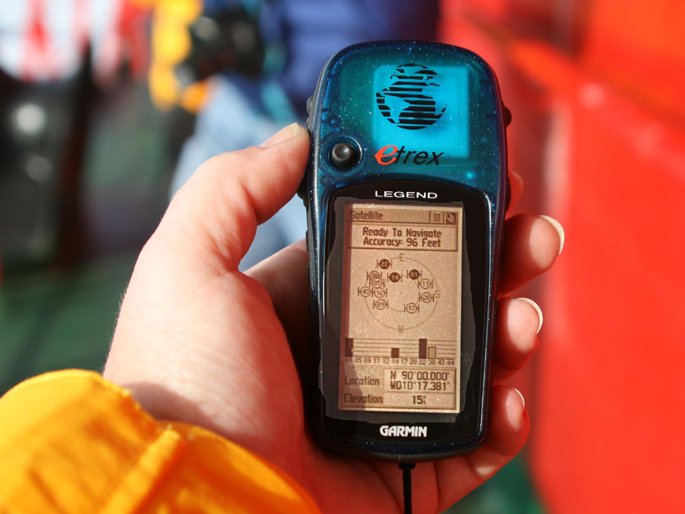
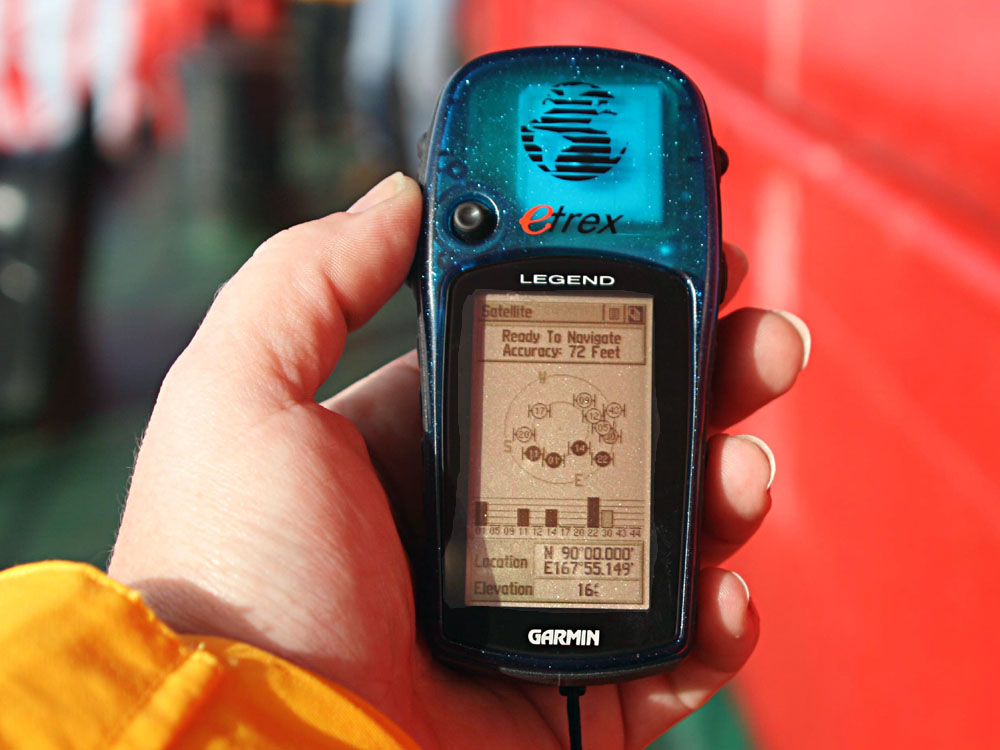
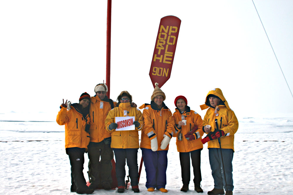
90° North
 ...
...
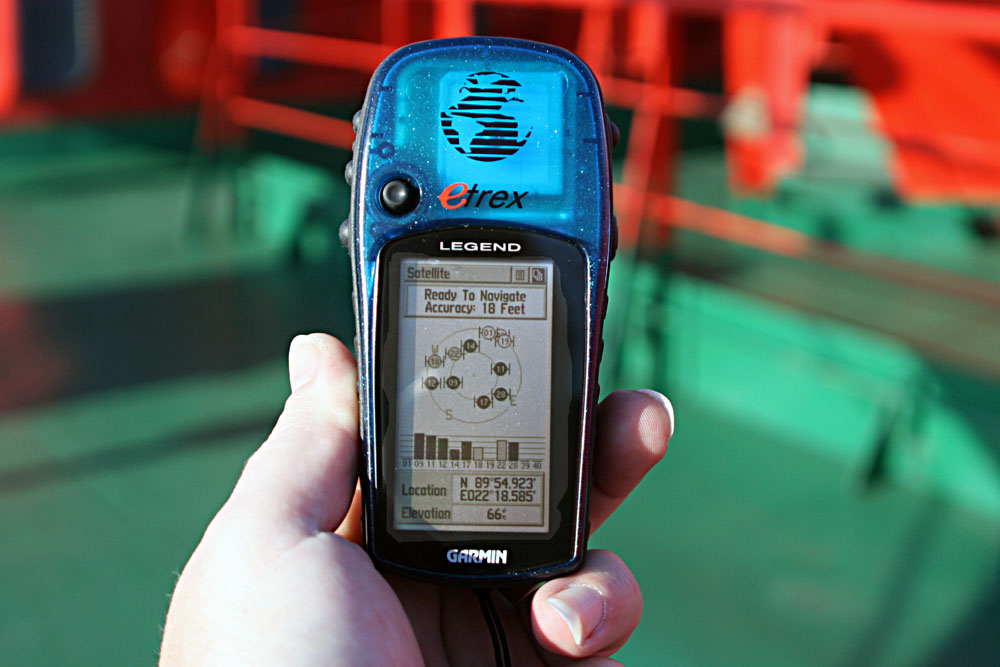
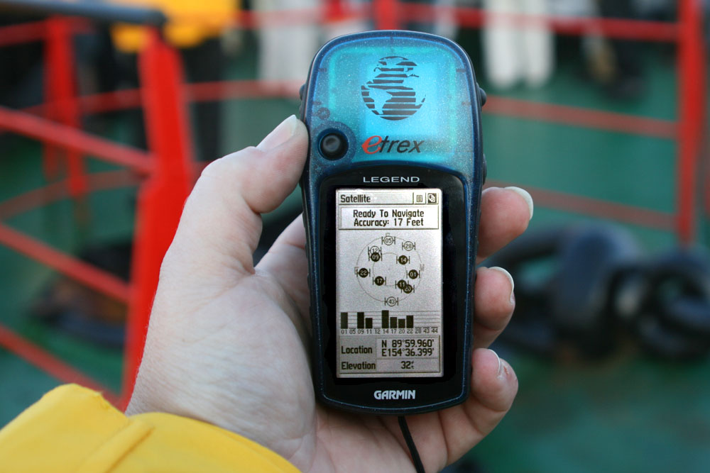
Sarah is standing over the North Pole (which is under
the ship). Here Longitude has no meaning.
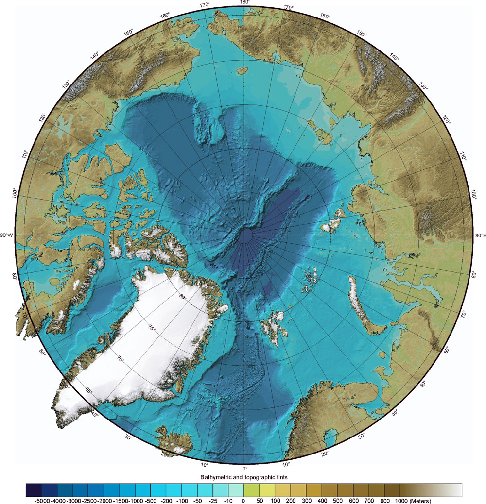
Making a GPS Chart of
the North Pole

First, one must find a good chart of the North pole
This IBCAO.jpg chart comes from (HERE).
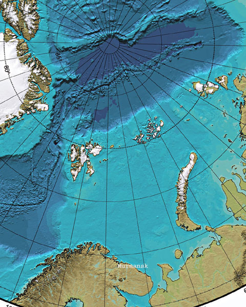
Next we rotated the chart 30° clockwise, so that
the starting point (Murmansk) would be at the bottom.
The hardest part was registering the
chart with Ozi Explorer, since
it didn't support Polar Coordinates.
After much experimenting, the Equidistant
Conic (EQC) projection and the WGS 84 Map Datum gave the best results.
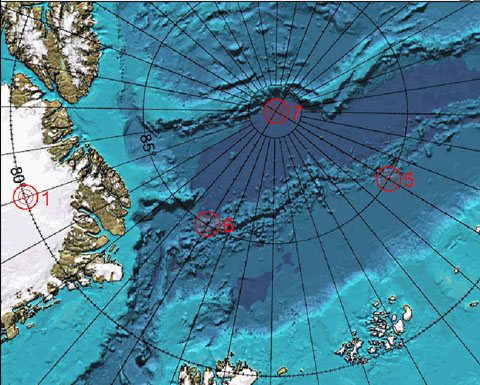
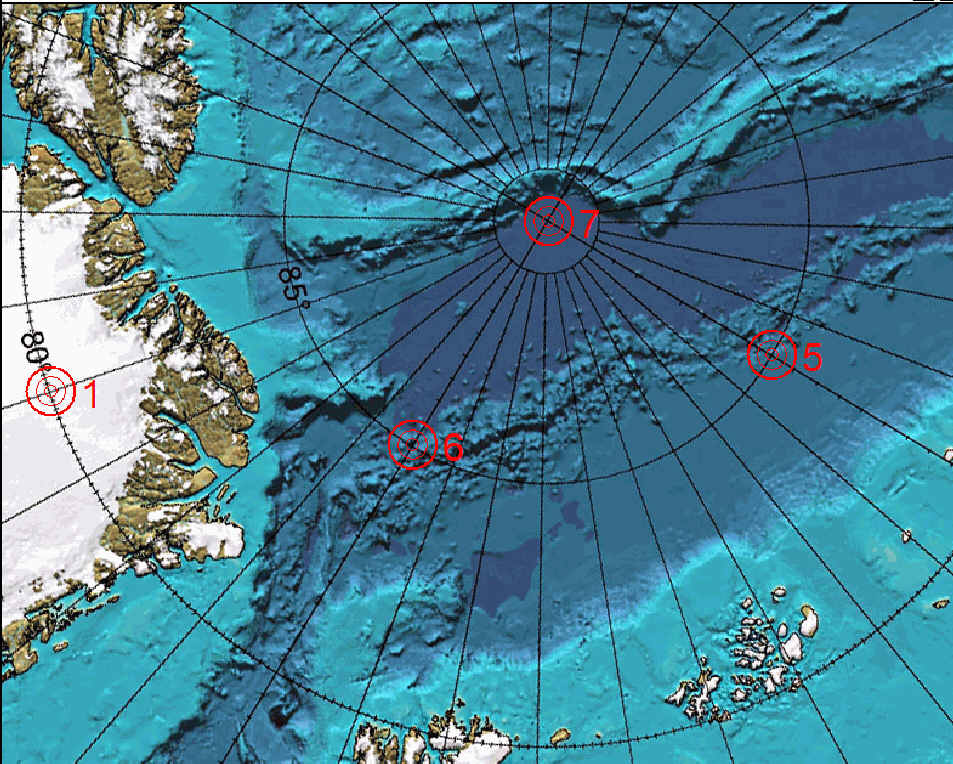
Here we have used seven known points
on the chart to "force feed" the registration with Ozi.
For a fully registered DRG chart compatible
with OziExplorer, get (THIS) file.
Sarah's waypoints and tracks can now be placed on this
GPS map of the Arctic.
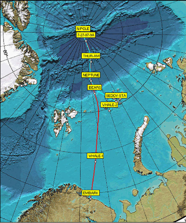
The trip starts from Murmansk "EMBARK"
(red track), and then back to the Franz Josef Archipelago (magenta).
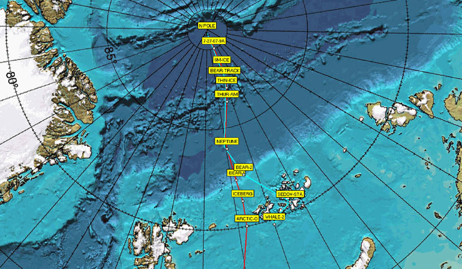
This is a more detailed view of the
northern tracks
Murmansk to the Pole
(Click
on thumbnails below for larger sizes)
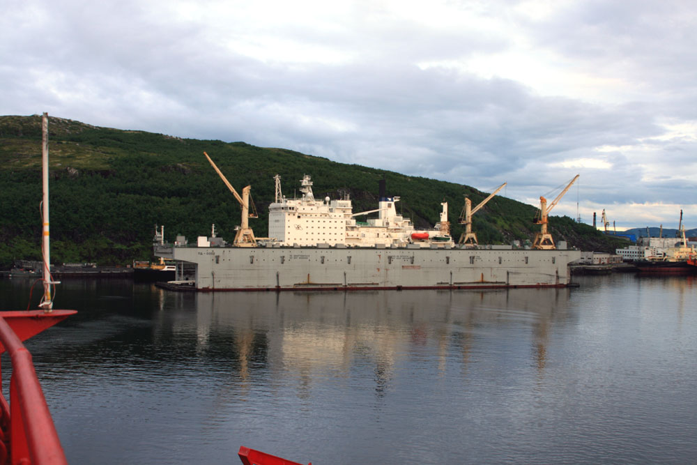
The first waypoint, EMBARK (July 22, 2007)
 .....
..... .....
.....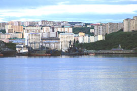
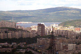
Murmansk, Russia Seaport ° Floating
Dry Dock ° Harbor Guarded by a large Statue
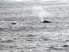
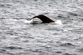
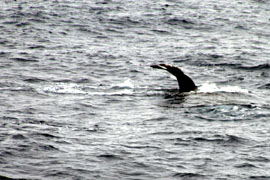
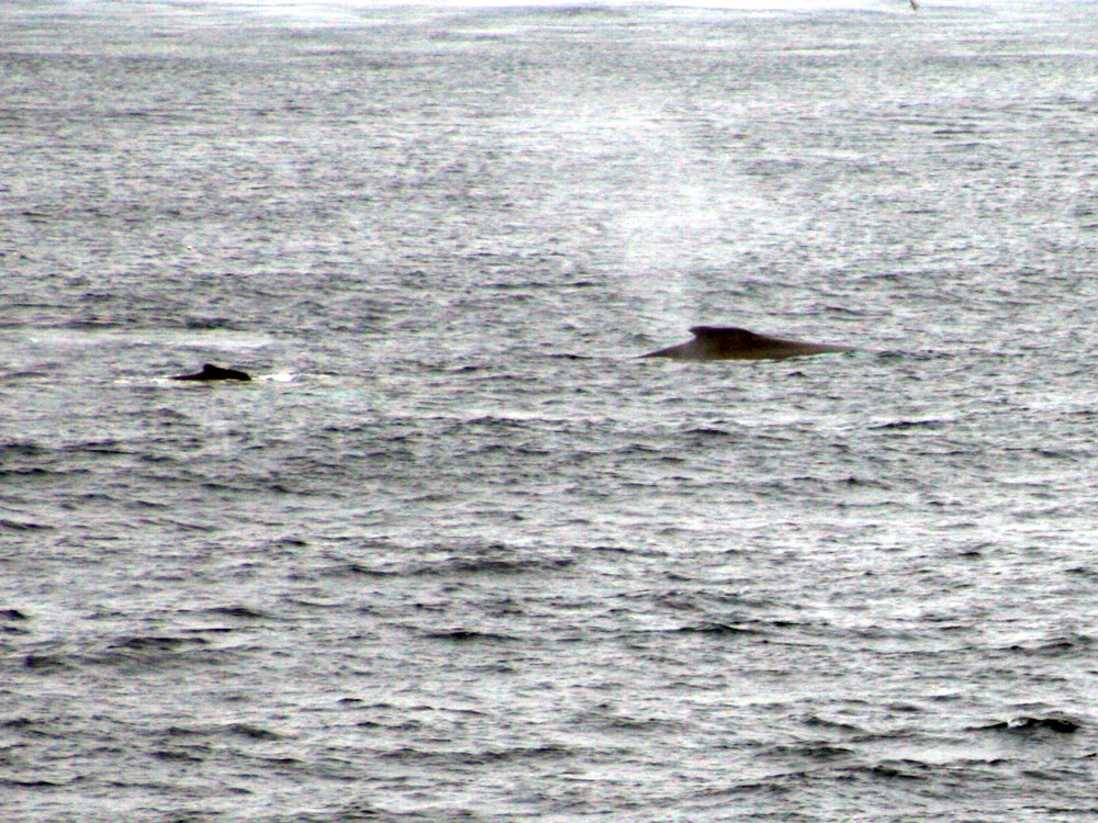
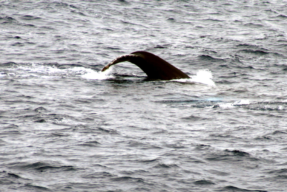
WHALE-1 (July 23, 2007)
 .....
..... .....
.....
Cold water doesn't bother these creatures.
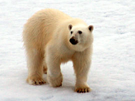
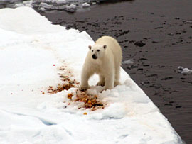
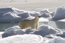
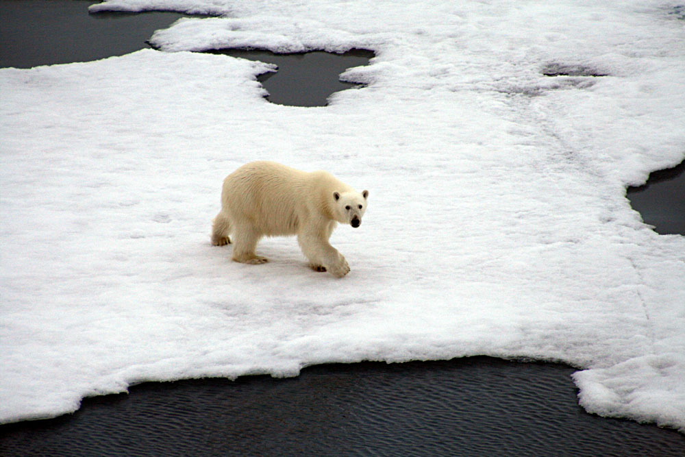
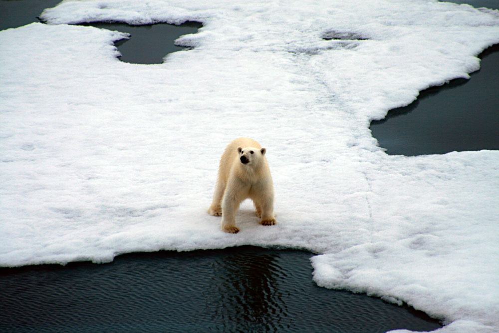
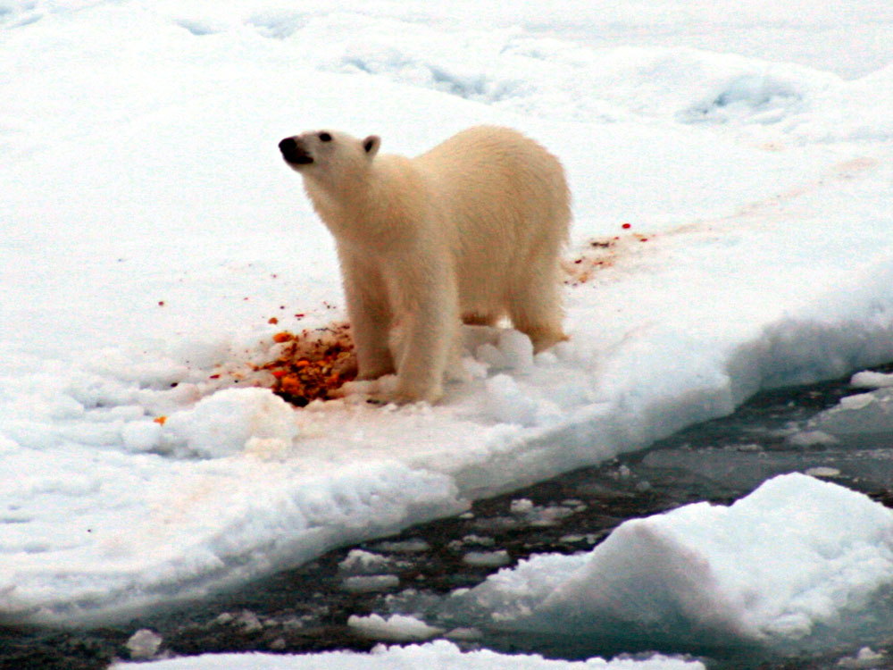
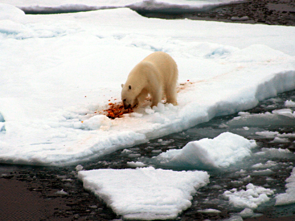
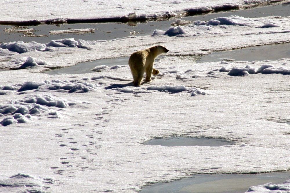
BEAR-1 (July 24, 2007)
 .....
..... .....
.....
 .....
..... .....
.....
This fellow had a nice breakfast.
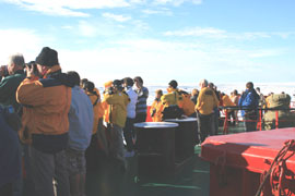
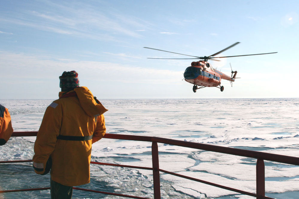
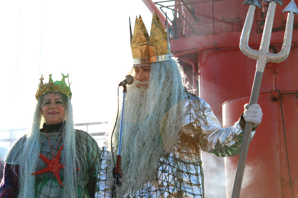
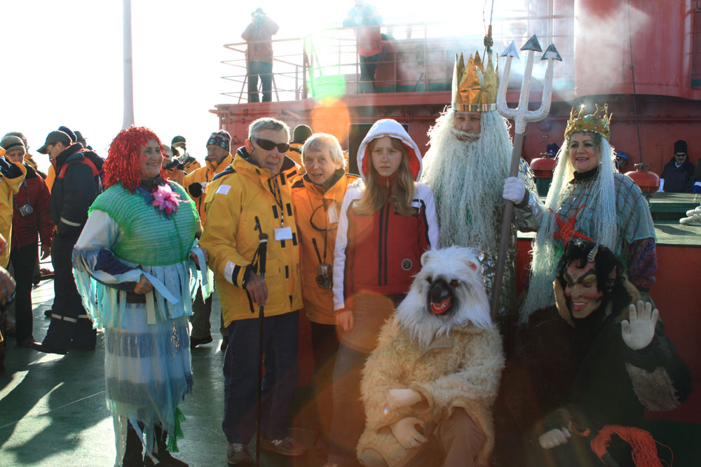
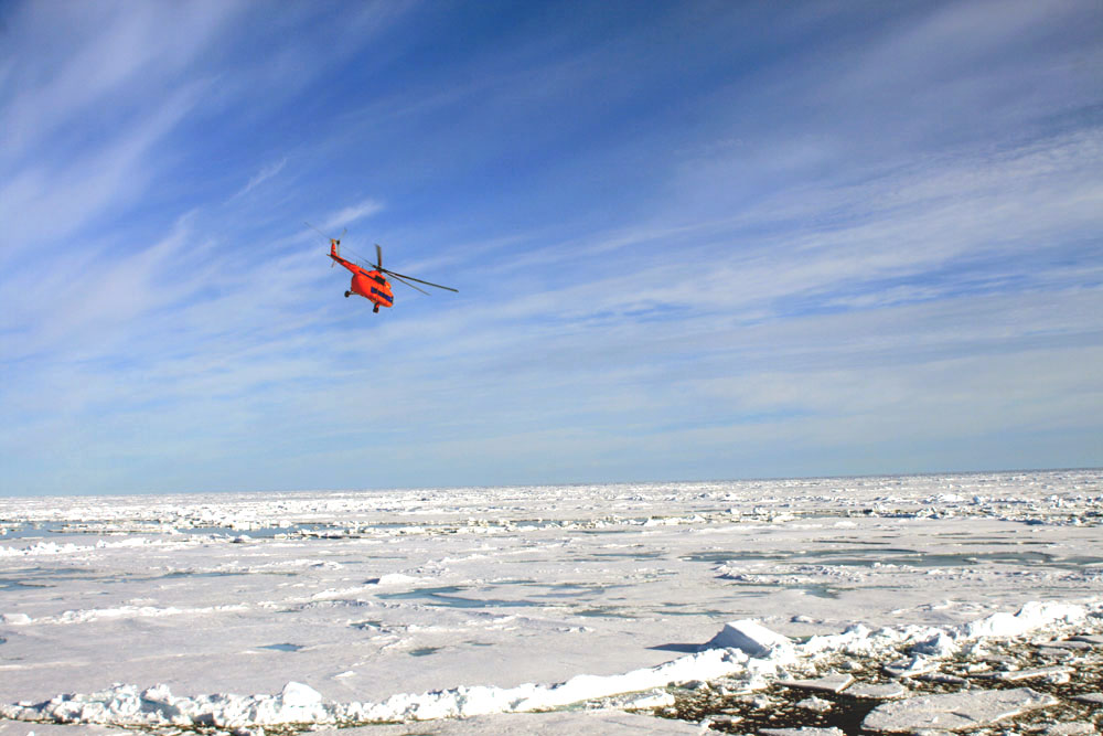
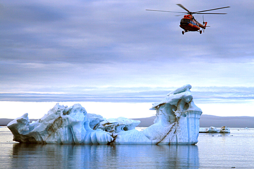
NEPTUNE (July 25, 2007)
 .....
..... .....
.....
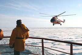
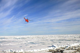
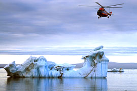
Passengers are treated to a helicopter
ride. ° The Yamal grinds along.
 .....
..... ...
...
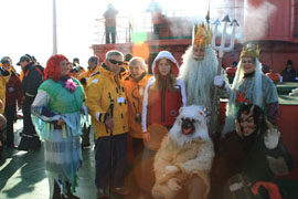
King Neptune summons his helpers and
has to make sure the people going to the pole are worthy. He then
gives them the
key to the north pole. Actually,
the story of King Neptune is a sailors story and is for when they cross
the equator,
but somehow the Russians use it for
going to the North Pole too. After being deemed 'worthy', the guests
all dance in circles!
THIN-ICE and 7-27-07-9A
 .....
..... .....
.....
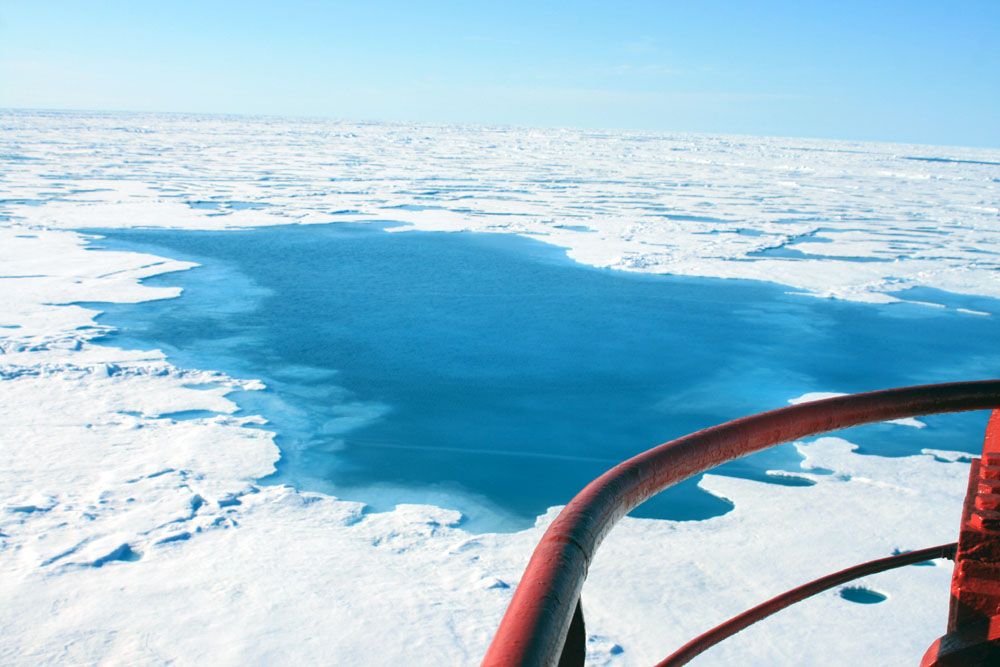
Yep, the ice is thin. ° This fellow
looks a little young to be piloting an icebreaker! ° Here the ship
is about 50 miles from the pole.
July 27, 2007, the day the ship made it to the North
Pole
 .....
..... .....
.....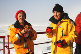
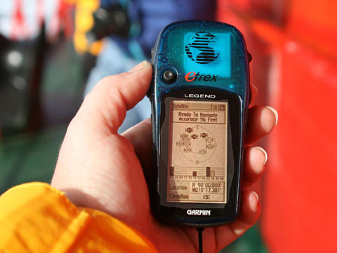
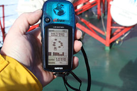
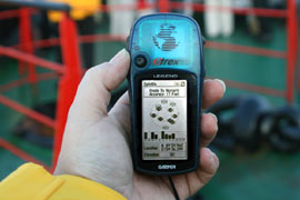
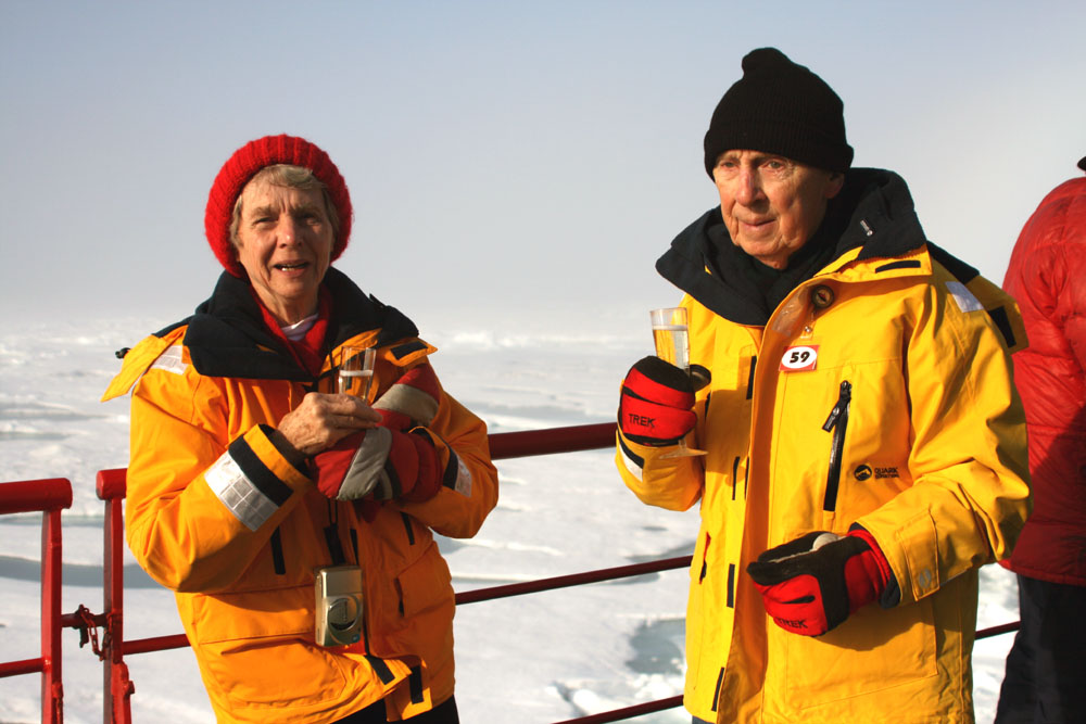
The GPS indicates 5 miles from the
pole. ° North Pole? It must be out there somewhere. ° Hey,
we made it; let's celebrate!
 .....
..... ....
....
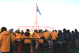
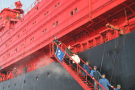
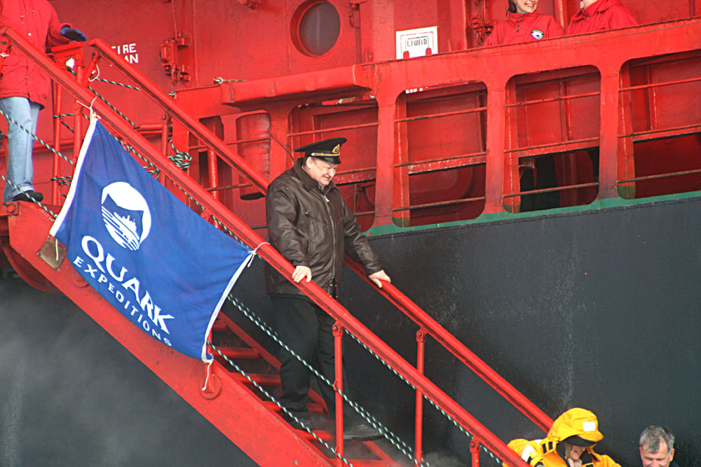
OK, everybody out. ° Doesn't look
like the captain is the last to leave his ship! ° Now, let's find that
Pole.
 .....
..... .....
.....
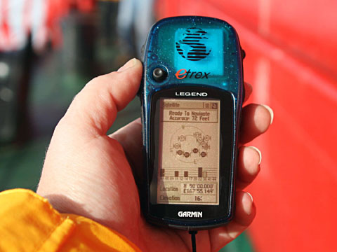
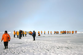
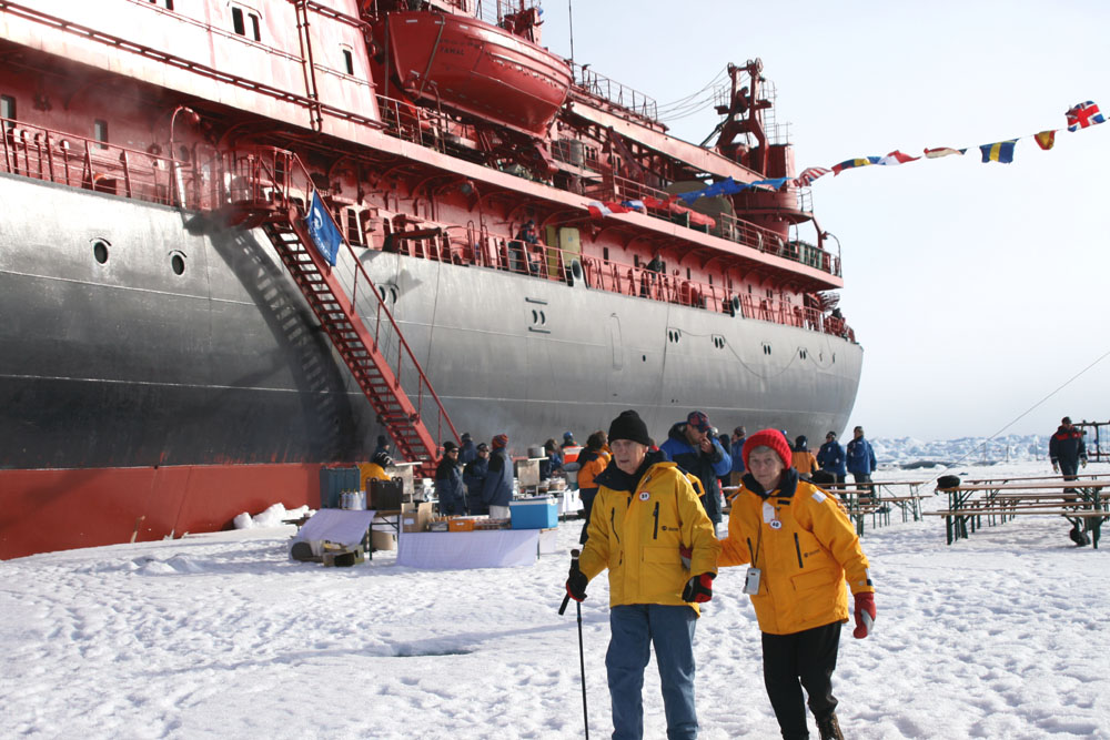
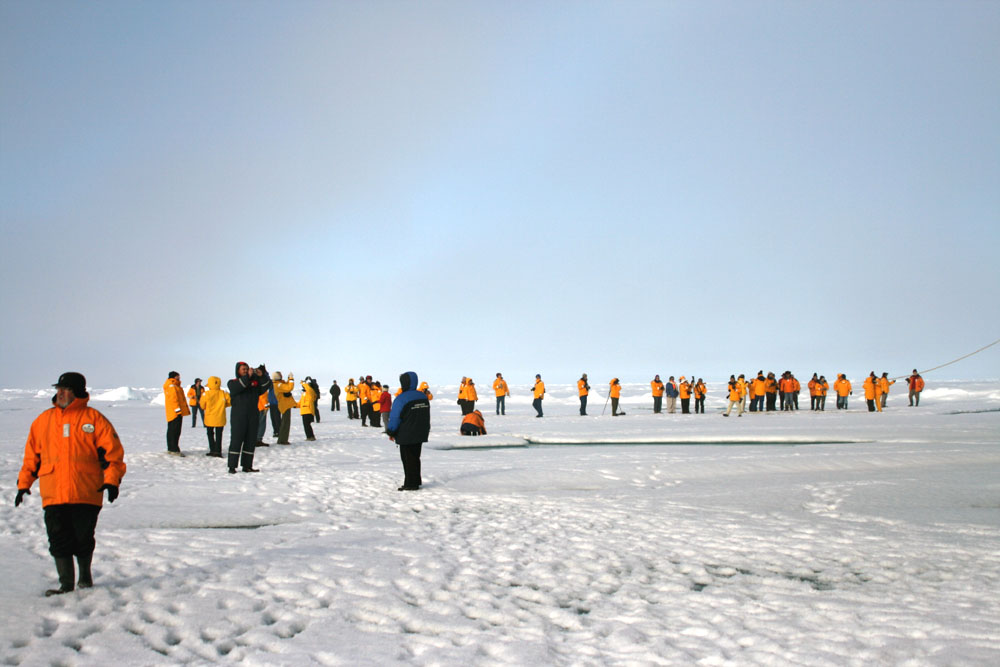
Everyone is searching for the Pole.
° Yamal would rather 'eat' the Pole. ° The Pole is actually under
the ship, 240 feet from Sarah.

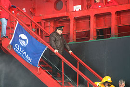
Oh heck, let's call it HERE! °
(Sarah is from Madison, WI)
The Pole back to Murmansk
.. .....
..... .....
.....
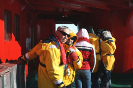
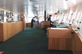
Accommodations aboard the Yamal are
First Class!
July 29, 2007
 .....
..... .....
.....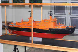
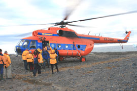
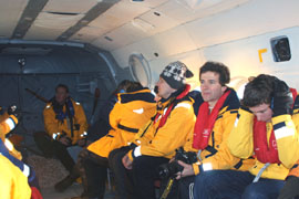
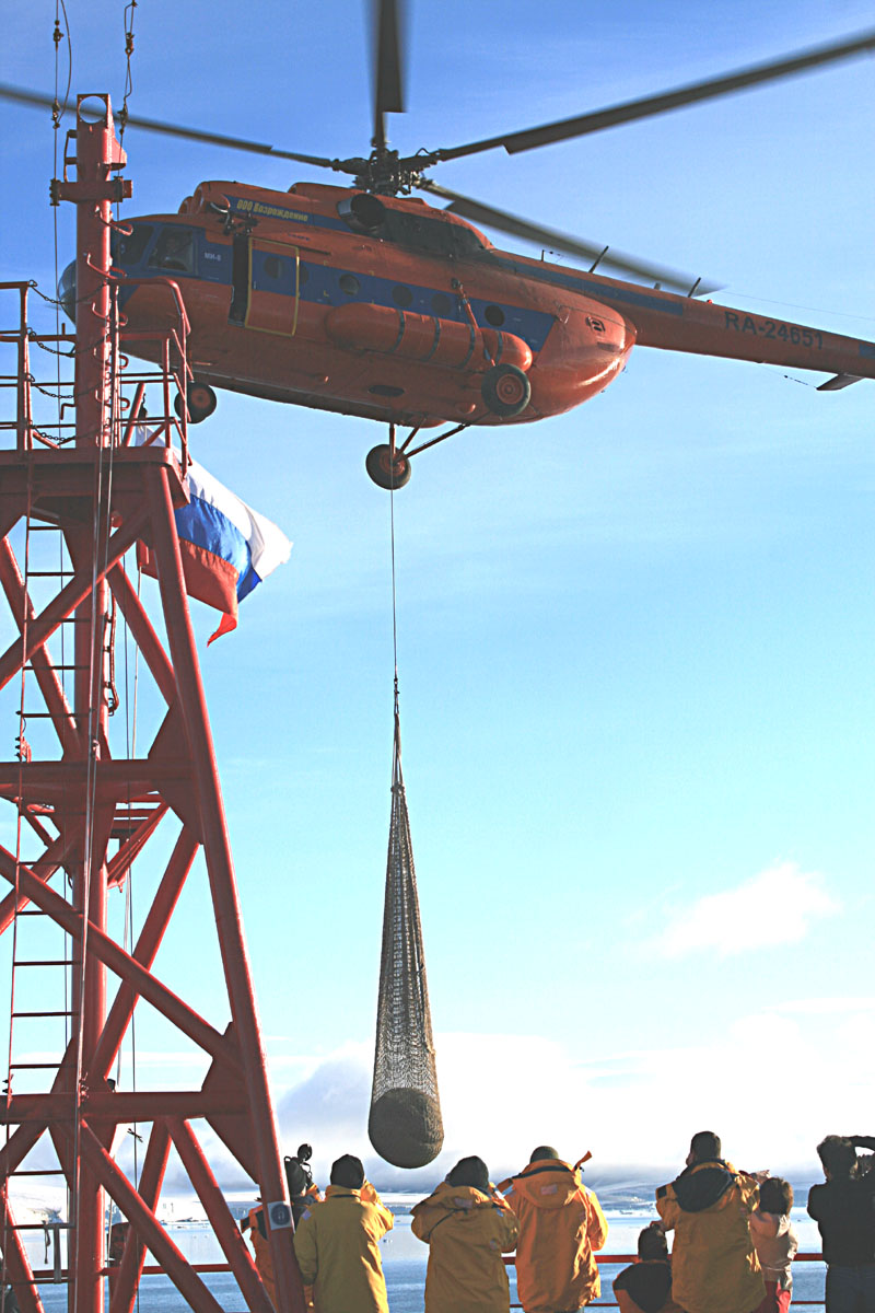
Another Sight-seeing Helicopter Ride
which can carry 10 to 12 passengers at a time.
(A model of the Yamal's sisiter ship
is in the Murmansk Museum)
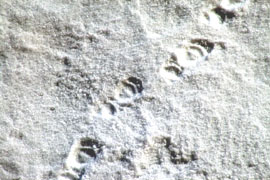
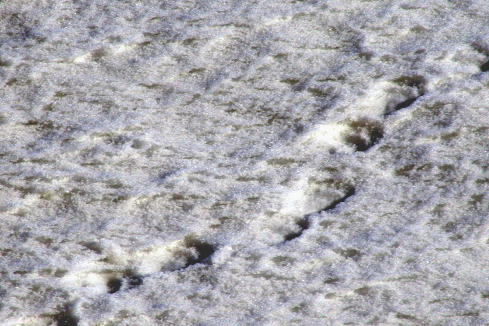
BEAR-TRACK (July 30, 2007)
 .....
..... .....
.....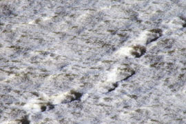
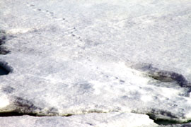
Bear Tracks about 150 miles south of
the Pole
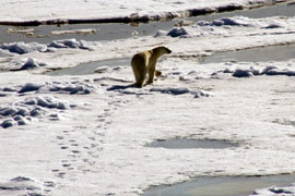
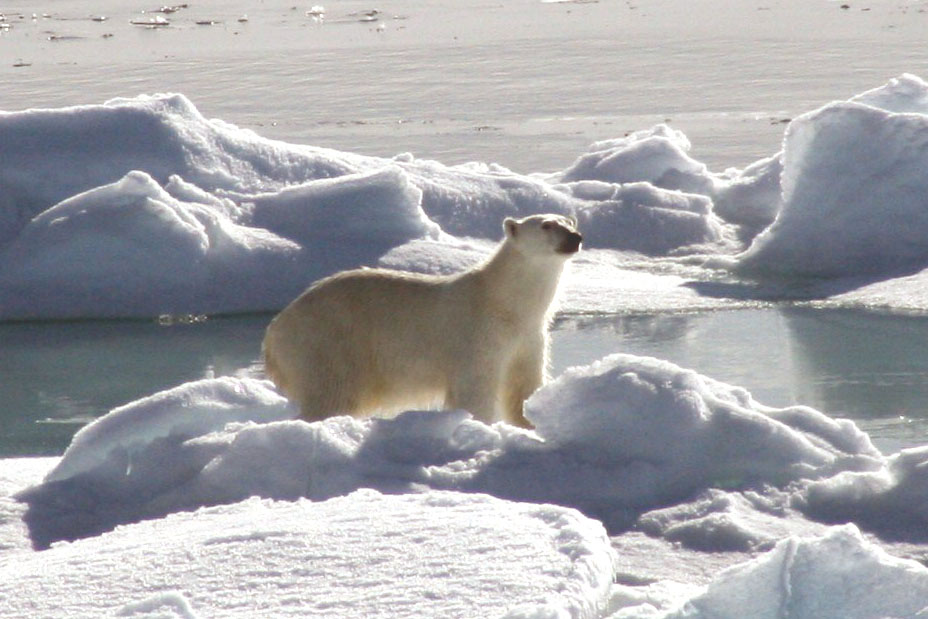
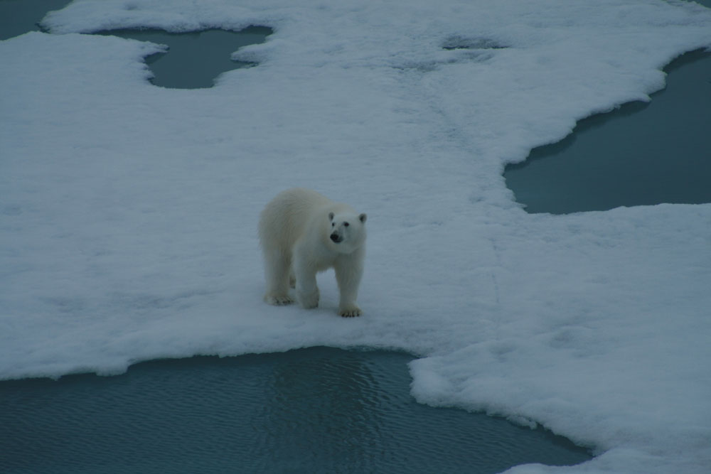
BEAR-2
 .....
..... .....
.....
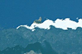
OK, so what's all the excitement about?
° -A beautiful bear posing for his picture!
 .....
..... .....
.....
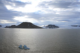
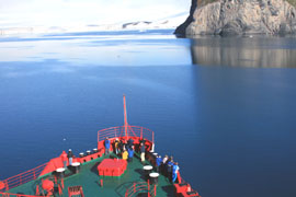
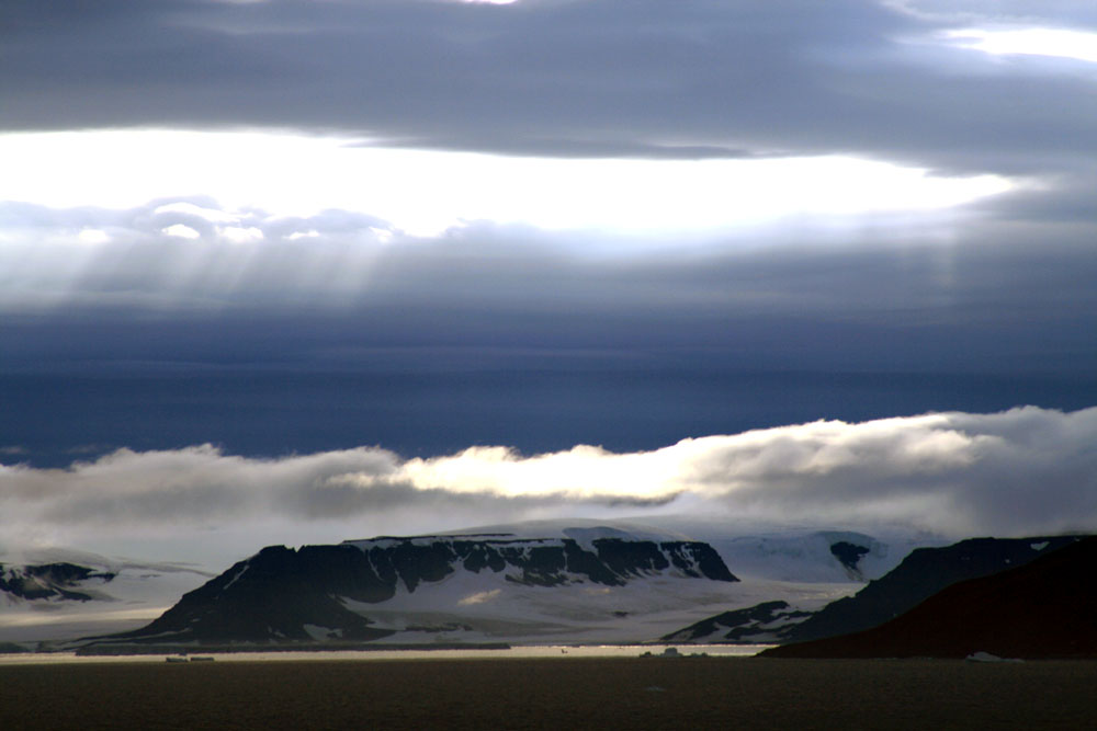
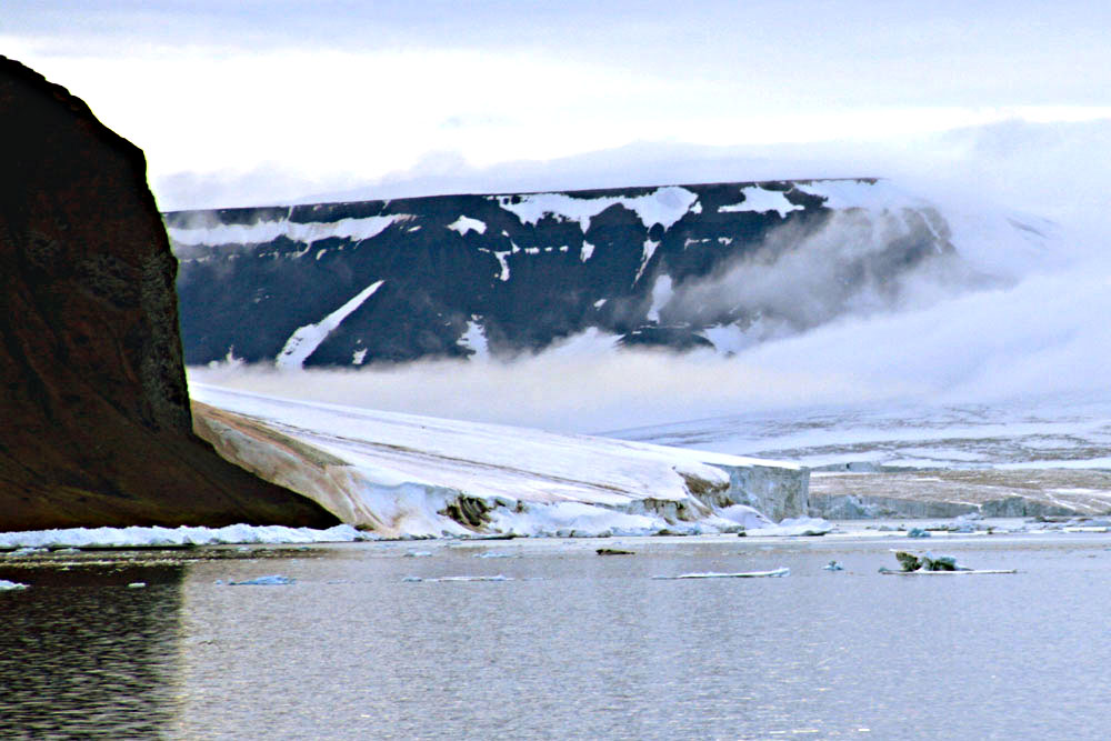
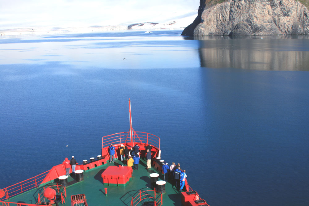
Approaching the Franz Josef Archipelago
 .....
..... .....
.....
Interesting reflection of the ship
in calm waters.
Sarah is the faint tan smudge at the
top of the white taking the picture.
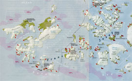
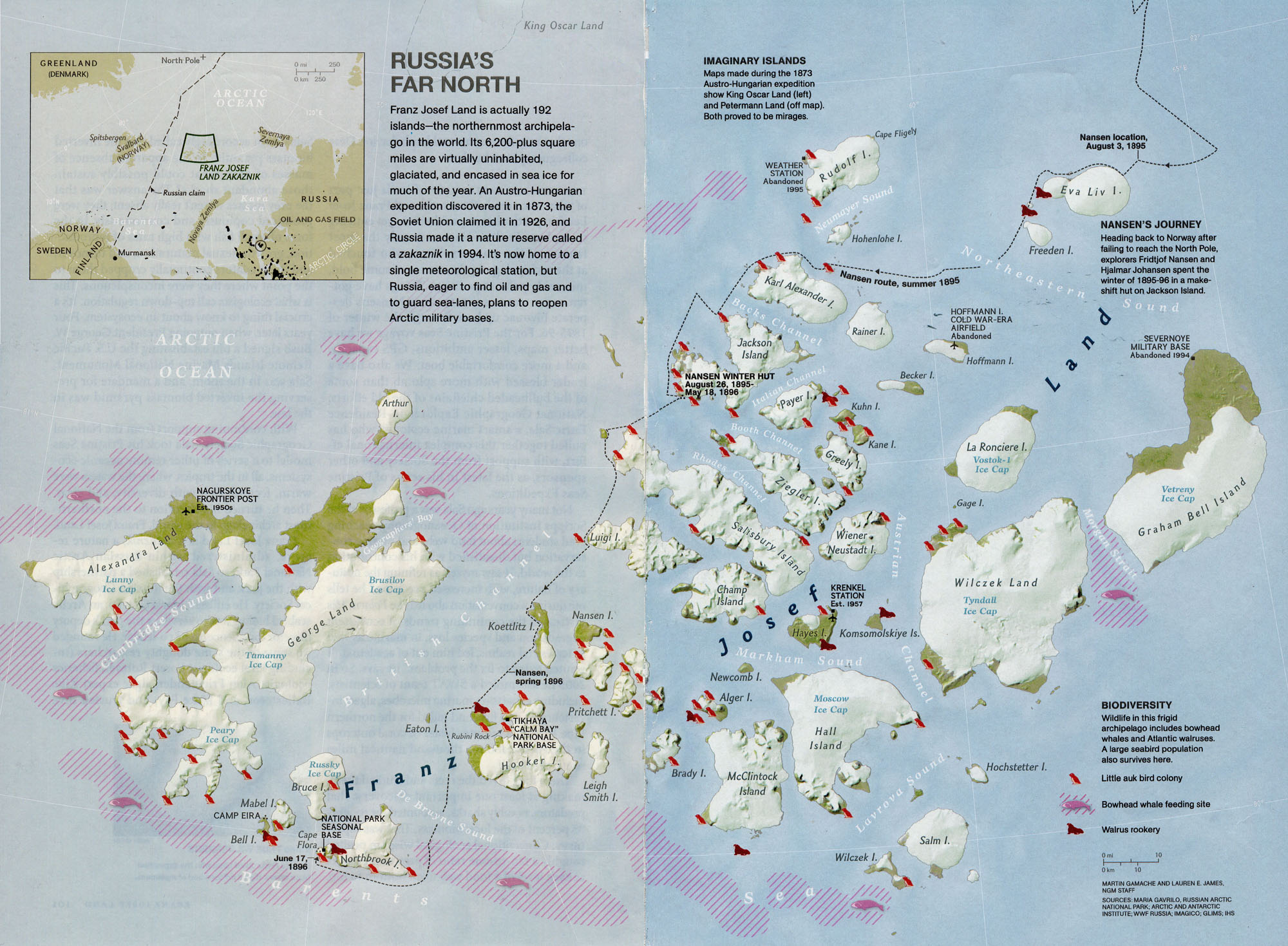
Aug. 2014 detailed National Geographic
map of Frans Joseph Land and route of Chasing
Nansen's Ghost
by Børge Ousland and Thomas
Ulrich (below)
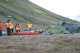
July 30, 2007 Ashore
 .....
..... .....
.....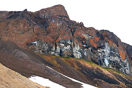
The Trusty Three-engine helicopter
lands on Champa Island. The ice-capped mountains are the highest
on the archipelago.
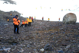 .....
..... .....
.....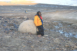
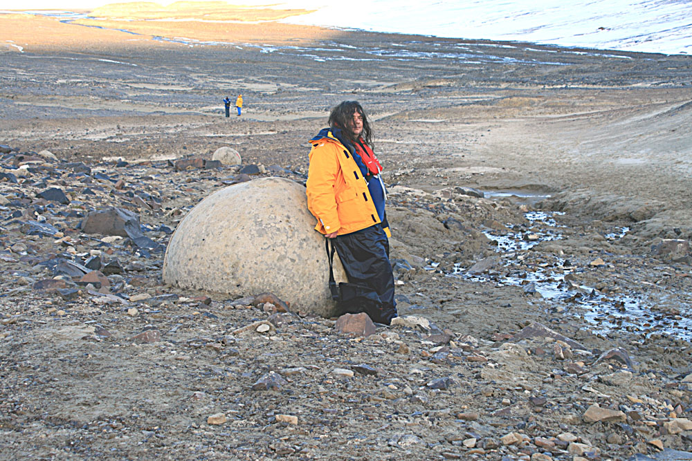
-To observe huge geodes, one
of which was eventually transported back to the ship. And there aren't
many left!
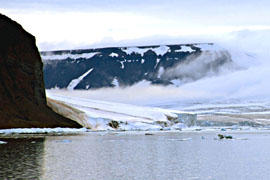
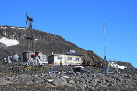
SEDOV-STA (July 31, 2007) Named for Rudolph Sedov,
early Arctic explorer, who is buried there.
 .....
..... .....
.....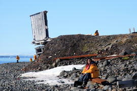
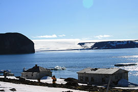
Hooker island and the abandoned Thikaya
station -which has "Hazardous" Comfort Facilities!
 .....
..... .....
.....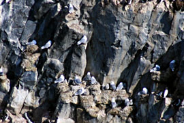
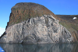
Rubini Rock in the distance is actually
a rookery for thousands of birds.
 .....
..... .....
.....
Another Helicopter
ride to Cape Flora on Northbrook Island.
Here they met National Geographic explorers,
Børge Ousland and Thomas Ulrich, who walked, skied, sledded, and
canoed from the North Pole to Cape
Flora. Now waiting to be picked up by ship. See (HERE)
for the complete story.
 .....
..... .....
.....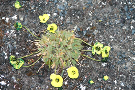
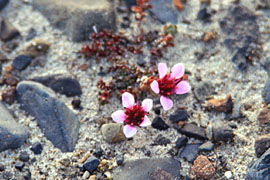
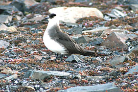
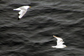
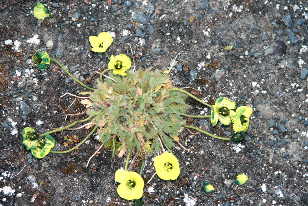
Wild life hangs on even in severe conditions.
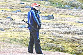
The Bear Guard?
For even more information about Franz-Josef-Land, see
Andreas Umbreit's web page (HERE)
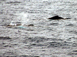
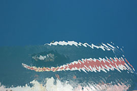
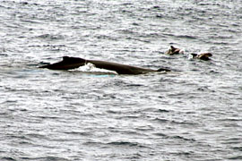
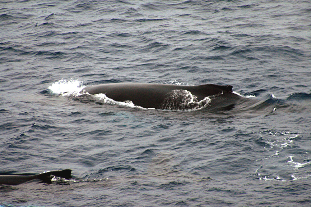
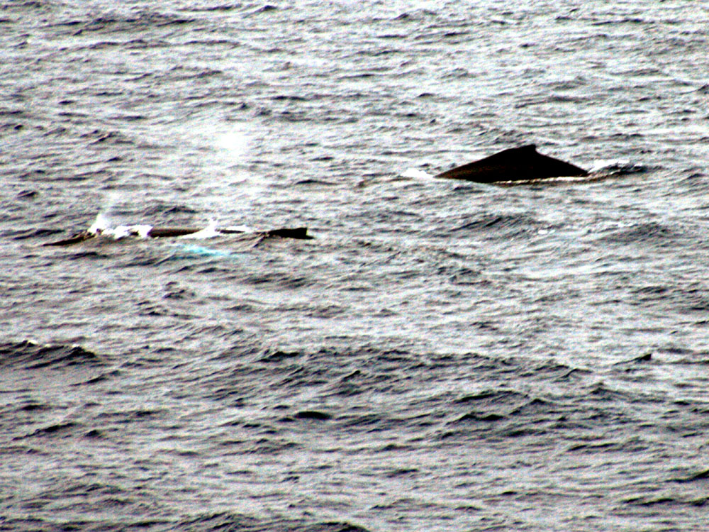
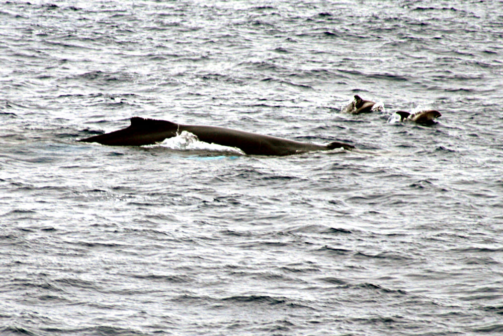
WHALE-2 (Aug. 1, 2007)
 .....
..... .....
.....
There appears to also be two calves
traveling along.
 .....
..... .....
.....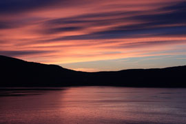
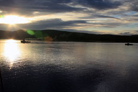
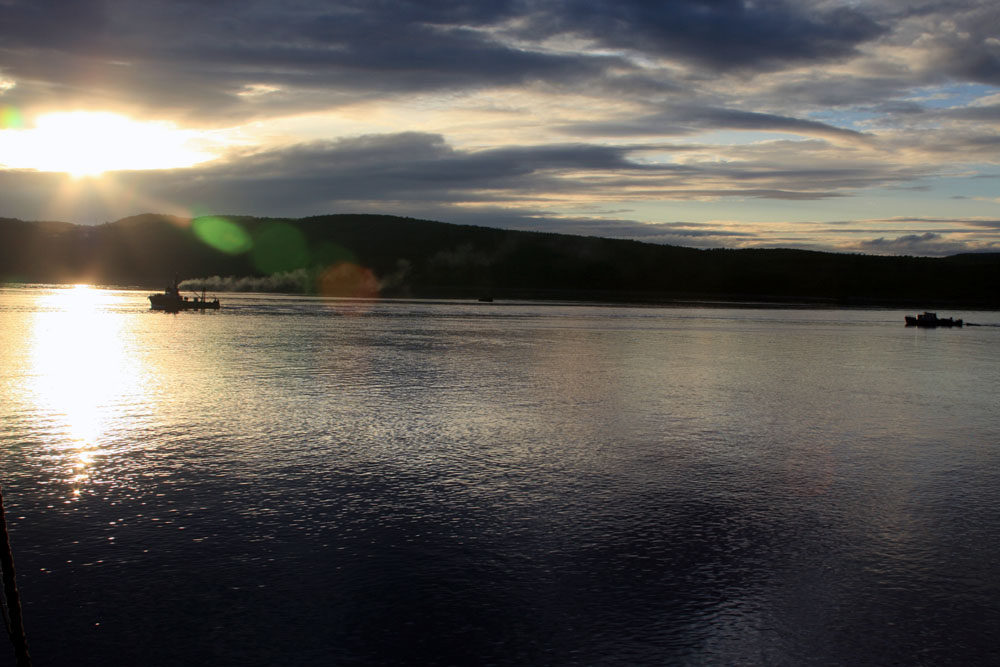
This is as low as the sun got on the
whole trip
Aug. 2, 2007
 .....
..... .....
.....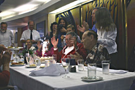
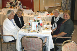
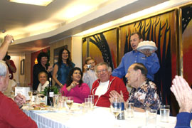
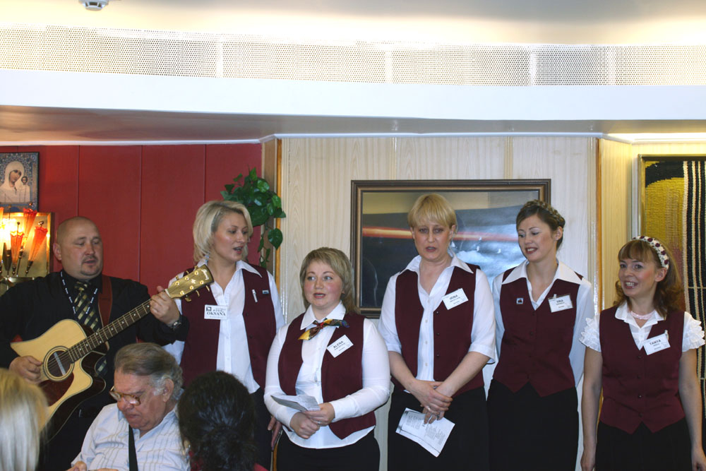
These Russians have lots of rosy cheeks
° The Last dinner aboard the Yamal went off with a BANG!
 .....
..... .....
.....
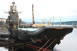
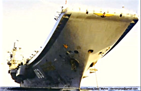
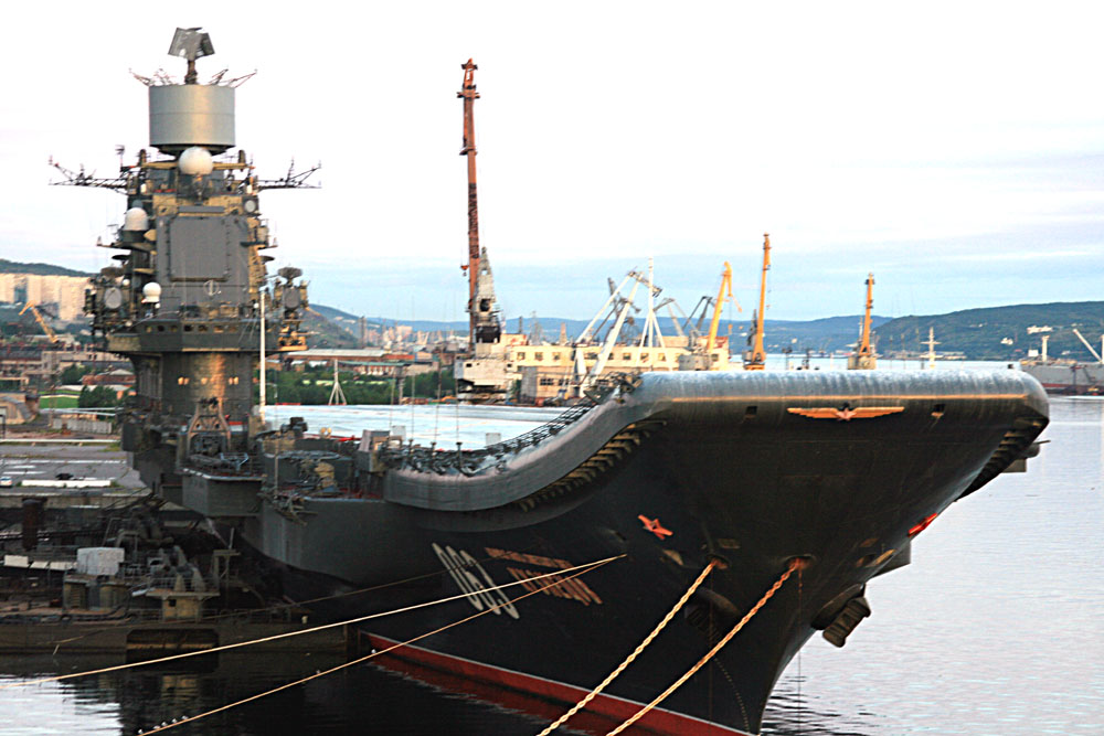
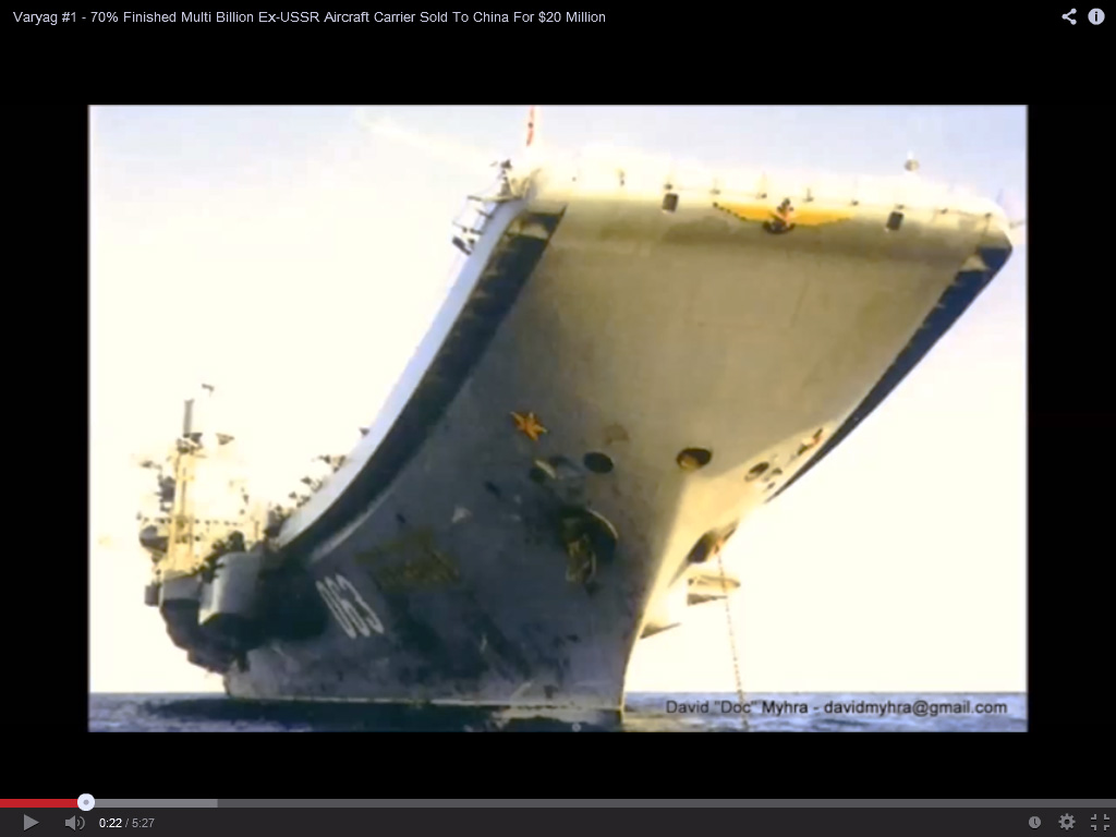
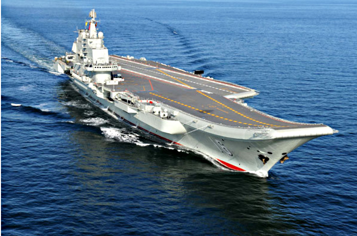
Murmansk Harbor, Aircraft Carrier
Kuznetsov ° Similar Varyag during conversion ° The
New Chinese Carrier, Liaoning
The Chinese carrier, Liaoning, is
the retrofitted Russian carrier Varyag
Watch: http://www.youtube.com/watch?v=v7bjOvKV71s
 ..........
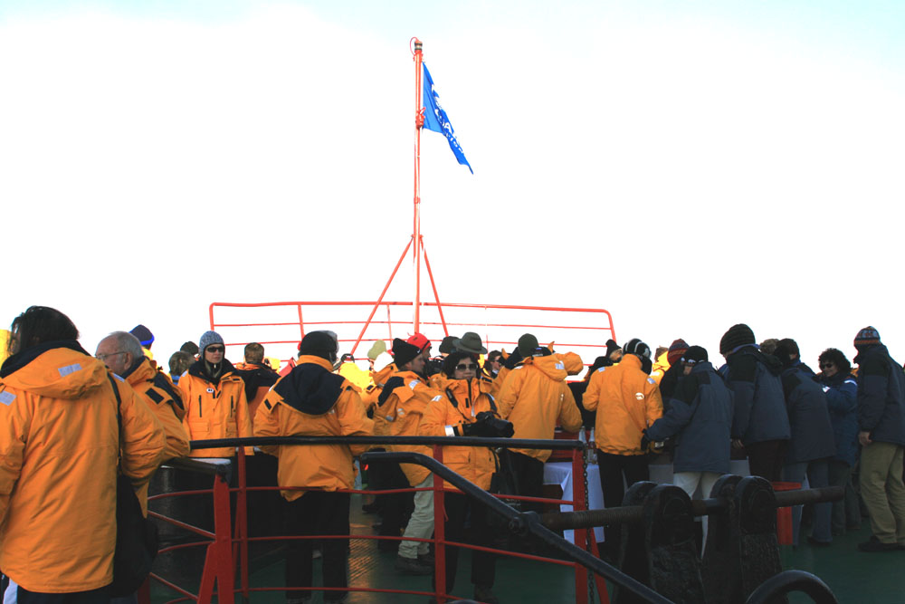
The "Welcoming Committee" back Home

 ...
...


