Costa
Rica Tour and Panama Cruise with CruiseWest, Feb. 2005
This
review has been completely revised to include the new CenRut
GPS maps of:
Belize,
Guatemala, Honduras, El Salvador, Nicaragua, Costa Rica, and Panama.
(Donations
to CenRut welcome) Text
and Photos by Jack Yeazel °
6 Sept. 2012
Return
to GPS General Information Home Page
These
maps have been successfully loaded into a Garmin GPSmap 76c, & 76Cx
( protocal),
and
78Sc & Dakota 20 (mass storage) hand-held units.
Here are some
examples of loading both types of maps into a Garmin GPSmap
78sc.
 .....
..... .....
..... .....
..... .....
.....
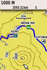
Courtyard Hotel ° Inbio Park near San Jose ° Arenal
Inn, Hot Springs Swimming ° Closer view of Arenal Volcano ° North
end of Canal at night
NOTE: Placing the cursor on a street or contour reveals the name
or height. (Blue is a GPS track on land and pink is the track of
the ship)
To record this
trip, we took two Garmin receivers and a Magellan SporTrak Color.
Generally we used a Garmin Vista-C to record the bus and walking tours,
a GPSmap 76C to record the ships position 24-hours a day, and a Sportrak
Color to show contour lines. The CenRut maps are remarkably detailed
and accurate -as compared to the GPS tracks recorded on the trip.
Due to lack of memory, those three units aren't capable of accepting the
CenRut regions, so we will describe the units we know that can.
MAP INSTALLATION
INTO GARMIN UNITS DIRECTLY:
In the http://www.cenrut.org/adw/over.htm,
Overview page is, "How do I load the maps onto my GPS?"
Once you get the gmapsupp.img file, you can upload it to any Garmin unit
that supports "Mass storage" where other .img files are located.
If you find a gmapsupp.img file already there, change the name to gmapsupp.img.org,
or similar, to prevent overwriting that file. (Later you may want
to go back to the original .img file).
MAP INSTALLATION
INTO GARMIN UNITS VIA MAPSOURCE:
In the CenRut
Overview page is, "item 3) CenRut*: http://bit.ly/Cenrut28". Download
this file to the same folder of convenience. It will be, "CenRut28.rar".
NOTE: *.rar files
must be extracted by downloading http://www.tucows.com/preview/194276
-or similar. (Try not let the 'extra' files by TuCows clutter up
your computer!). This file will be: "oi_wrarexe.exe" which
downloads "wrar411.exe". Run this file to install 'WinRAR' on your
computer. (If you are using PKZIP, I suggest you only register WinRAR
to extract *.rar files).
Now you can extract
"CenRut28.rar". There will be a sub folder, "CenRut28", where you
will find, "CenRut.org 2.8.exe".
Running this
file will install the "CenRut 2.8" map on your MapSource. To
check the success of the install, load (THIS)
Garmin .gdb file with waypoints and tracks from a previous visit to Central
America into MapSource -which can show the accuracy and detail of the map.
NOTE: With some Garmin 'mass storage'
hand-held units, the uploaded tracks aren't visible on the screen until
they are activated individually.
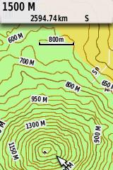
ADD TOPOGRAPHIC
MAPS:
Also on the Overview
Page is "Topographic map of Central America". Download and run "Centopo.exe".
This will install 50m (164') contour-line-interval map derived from NASAs
SRTM data. On MapSource, the map will be "Centopo 01 www.cenrut.org©"
and will show contour lines only.
To add CenRut
street maps AND contour lines onto a GPS unit, select both 'CenRut 2.8'
and 'Centopo 01 www.cenrut.org' regions of interest. Upload these
regions to you GPS unit.
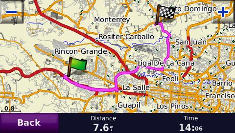
ROUTING:
Routing on the
Garmin nuvi series seems to work well. Below are two calculated routes
as compared to a rout actually taken. But so far, we haven't been
able to do route calculations on the hand-held units we have that will
accept CenRut maps.
 ...
...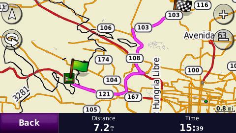
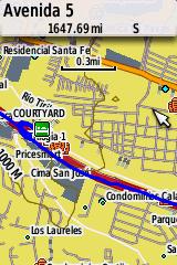
A route from
the Courtyard Hotel to the first stop, Inbio Park, as calculated by a Garmin
nuvi 760 and 765T
The newer 765T
finds a shorter route. (Black lines are contour lines)
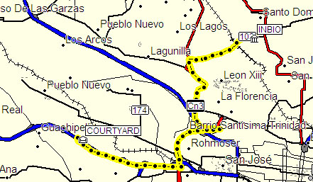
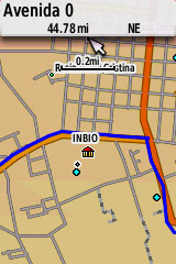
A GPS track of
the route actually taken by the bus -which is the same as the 765T.
WEATHER:
In February, Costa Rica, Atlantic side, is
cool and sometimes showery. Costa Rica, Pacific side, warm and humid.
Seas fairly calm. Panama Pacific side, cool and pleasant (due to
the Humboldt Current). Atlantic side, warmer, but still rather pleasant.
Seas more windy and choppy. We would suggest you select a cruise
in the Costa Rica-to-Panama direction in order to get your sea legs for
the Atlantic side. Winter is considered the dry season in Central
America.
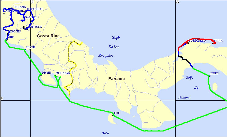
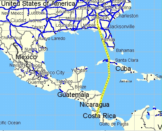
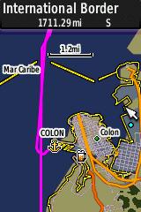
Overall GPS StreetAtlas map of the trip. Blue
is Land Tour of Costa Rica, Green is the Ship Cruise in the Pacific Ocean.
Black is the Panama Canal, and Red is the
return Cruise in the Caribbean Ocean from the San Bas Islands to Colon.
Part-I
Costa Rica Tour (5 Feb. to 10 Feb. 2005)
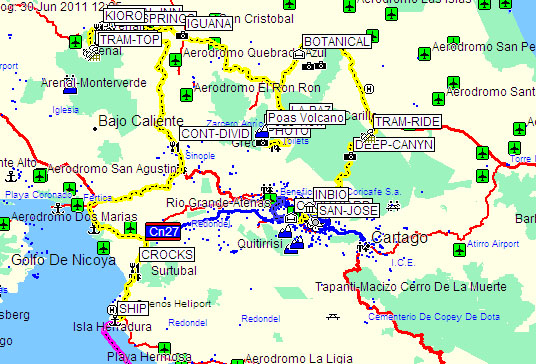
The "yellow brick
road" is a GPS track of the CRT bus tour superimposed on CenRut's new map
Click on these Thumbnails to
Access Web Pages of Interest
 .....
..... .....
.....
-
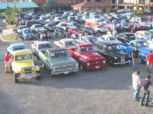
Antique Auto Display
near the Marriott Courtyard Hotel. -First night stay.
-
Inbioparque -Display
of aquatic animals and fish of Costa Rica, some being endangered species.
-
Rain Forest Aerial
Tram and Restaurant, Braulio Carrillo National Park.
 .....
..... .....
.....
-
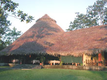
Centro Neotropico
SarapiquiS Hotel -Botanical Gardens and Archaeological Site. -Two
nights stay.
-
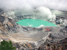
Poás Volcano
National Park.
-
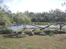
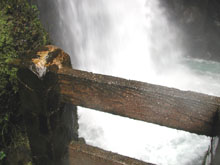
La Paz Waterfall
and Restaurant -northeast of the Volcano.
 .....
..... .....
.....
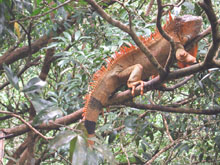
-
"Green" Iguana "à
la mode" (see page).
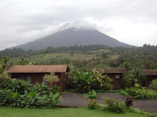
-
Arenal Volcano view
from the Arenal Paraiso Hotel Cabins. -Two nights stay.
-
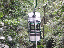
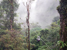
Sky Tram and Zip
Line launch point -The destination is invisible!
 .....
..... .....
.....
-
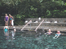
Hot Springs and Pools.
-
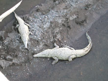
Just when you thought
it was safe to go in the water! (On the way to the dock).
-
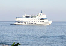
Cruise West Pacific
Explorer.
Part-2
-Cruise on the Pacific Explorer (11 Feb. to 19 Feb.
2005)
The Yellow Line
is the ship track of the Pacific Explorer superimposed on Garmin's WorldMap
Click on these Thumbnails to
Access Web Pages of Interest
 .....
..... .....
.....
-
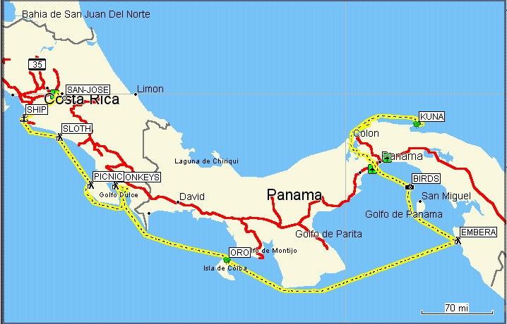
Wild Capuchin (observing
beach person) in the Manuel Antonio National Park.
-
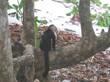
Macaw in the Wildlife
Hospital of the Cana Blanca Preserve.
-
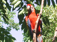
Granito de Oro (Little
Grain of Gold) Island -Model for all deserted-island cartoons?
 .....
..... .....
.....
-
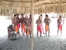
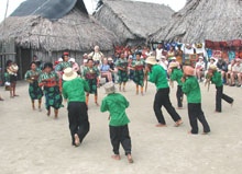
The indigenous people
of Emberá -Preparing music for a festive dance.
-
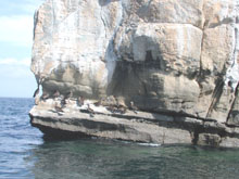
Pacheca Bird Island
of Panama.
-
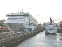
The Panama Canal
-Hotels can navigate this thing?
 .....
..... ...
...
-
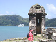
Portobelo -Discovered
by Columbus in 1502 (escaping from a storm), later fortified by the Spanish.
-
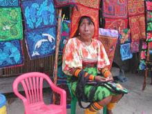
Kuna indigenous people
of the San Blas Islands -Natives sell their reverse appliqués.
-
Kuna native dance.
The men are playing flutes while the women shake maracas.
 ..........
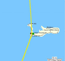
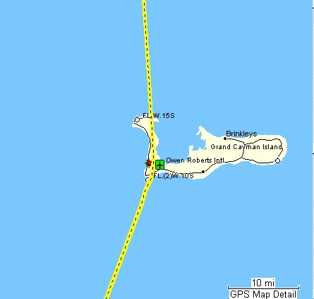
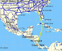
On the flight
down, I noticed a "kink" in the path south of Cuba.
It turned out
to be Grand Cayman Island. (Where the multinationals send all our money!)
Other Cruise West
Cruises with GPS:
Click (HERE)
for Alaska and Canada
Click (HERE)
for Baja California and the Copper Canyon
Photos taken with a Nikon CoolPix 990 and adjusted
with Adobe Photoshop Elements 2.0.