Costa
Rica Tour and Panama Cruise with CruiseWest
A
trip where Garmin and Magellan World Maps could be evaluated (28 Apr. 2005)
Text and Photos
by Jack Yeazel
Return
to GPS General Information Home Page
To record this
trip, we took two Garmin receivers and a Magellan SporTrak Color.
All performed without a hitch. On these pages, the maps with contour
lines are from Magellan's WorldWide Basemap, and those without, Garmin's
WorldMap. Generally we used a Garmin Vista-C to record the bus and
walking tours, a GPSmap 76C to record the ships position 24-hours a day,
and a Sportrak Color to show contour lines.
All tracks
were edited and displayed by G7ToWin.
Briefly:
Garmin's WorldMap shoreline, islands, and rivers were remarkably accurate,
almost as accurate as the marine charts. The highways, however, were
"hit and miss". The Magellan WorldWide Basemap topo maps had poor
coastline detail, but did have the contour lines. Their highways
were even fewer than Garmins.
WEATHER:
In February, Costa Rica, Atlantic side, is
cool and sometimes showery. Costa Rica, Pacific side, warm and humid.
Seas fairly calm. Panama Pacific side, cool and pleasant (due to
the Humboldt Current). Atlantic side, warmer, but still rather pleasant.
Seas more windy and choppy. We would suggest you select a cruise
in the Costa Rica-to-Panama direction in order to get your sea legs for
the Atlantic side. Winter is considered the dry season in Central
America.
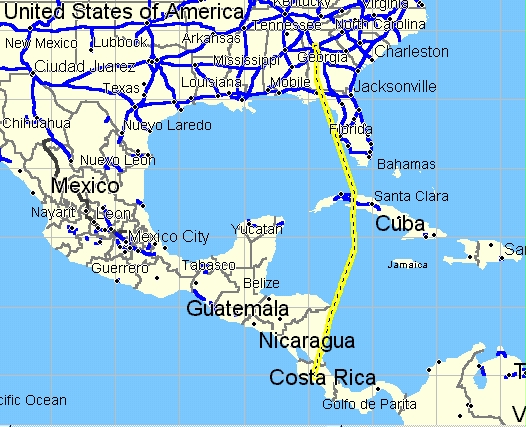
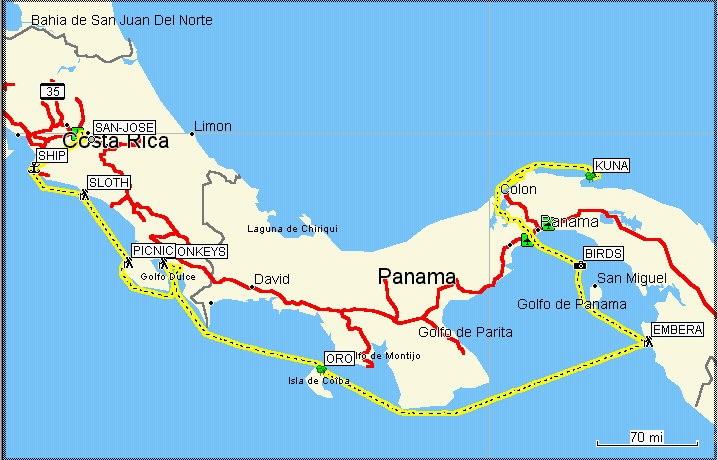
Overall GPS StreetAtlas map of the trip. Blue
is Land Tour of Costa Rica, Green is the Ship Cruise in the Pacific Ocean.
Black is the Panama Canal, and Red is the
return Cruise in the Caribbean Ocean from the San Bas Islands to Colon.
Part-I
Costa Rica Tour (5 Feb. to 10 Feb. 2005)
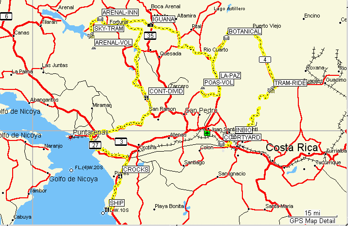
The "yellow brick
road" is a GPS track of the CRT bus tour superimposed on Garmin's WorldMap
Click on these Thumbnails to Access Web Pages
of Interest
 .....
..... .....
.....
-
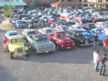
Antique Auto Display
near the Marriott Courtyard Hotel. -First night stay.
-
Inbioparque -Display
of aquatic animals and fish of Costa Rica, some being endangered species.
-
Rain Forest Aerial
Tram and Restaurant, Braulio Carrillo National Park.
 .....
..... .....
.....
-
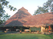
Centro Neotropico
SarapiquiS Hotel -Botanical Gardens and Archaeological Site. -Two
nights stay.
-
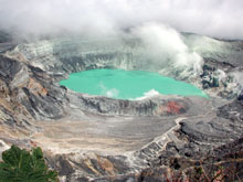
Poás Volcano
National Park.
-
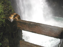
La Paz Waterfall
and Restaurant -northeast of the Volcano.
 .....
..... .....
.....
-
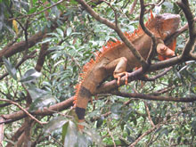
"Green" Iguana "à
la mode" (see page).
-
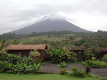
Arenal Volcano view
from the Arenal Paraiso Hotel Cabins. -Two nights stay.
-
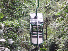
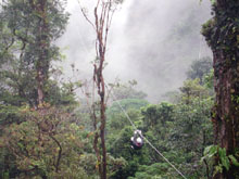
Sky Tram and Zip
Line launch point -The destination is invisible!
 .....
..... .....
.....
-
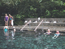
Hot Springs and Pools.
-
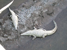
Just when you thought
it was safe to go in the water! (On the way to the dock).
-
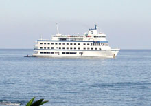
Cruise West Pacific
Explorer.
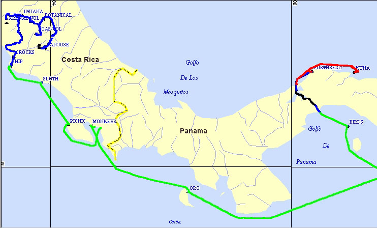
Part-2
-Cruise on the Pacific Explorer (11 Feb. to 19 Feb.
2005)
The Yellow Line
is the ship track of the Pacific Explorer superimposed on Garmin's WorldMap
Click on these Thumbnails to Access Web Pages
of Interest
 .....
..... .....
.....
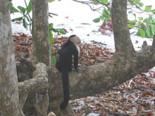
-
Wild Capuchin (observing
beach person) in the Manuel Antonio National Park.
-
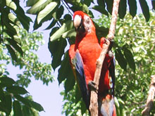
Macaw in the Wildlife
Hospital of the Cana Blanca Preserve.
-
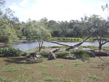
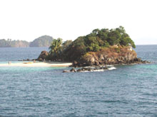
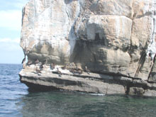
Granito de Oro (Little
Grain of Gold) Island -Model for all deserted-island cartoons?
 .....
..... .....
.....
-
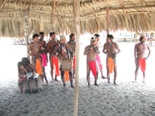
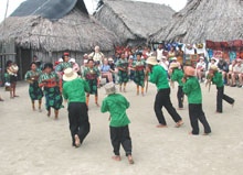
The indigenous people
of Emberá -Preparing music for a festive dance.
-
Pacheca Bird Island
of Panama.
-
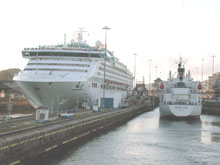
The Panama Canal
-Hotels can navigate this thing?
 .....
..... ...
...
-
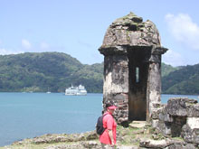
Portobelo -Discovered
by Columbus in 1502 (escaping from a storm), later fortified by the Spanish.
-
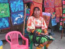
Kuna indigenous people
of the San Blas Islands -Natives sell their reverse appliqués.
-
Kuna native dance.
The men are playing flutes while the women shake maracas.
 ..........
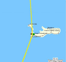
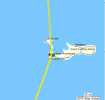
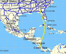
On the flight
down, I noticed a "kink" in the path south of Cuba.
It turned out
to be Grand Cayman Island. (Where the multinationals send all our money!)
Other Cruise West
Cruises with GPS:
Click (HERE)
for Alaska and Canada
Click (HERE)
for Baja California and the Copper Canyon
Photos taken with a Nikon CoolPix 990 and adjusted
with Adobe Photoshop Elements 2.0.